Geographic information systems (GIS) add a spatial component to an expansive and diverse variety of datasets, allowing for evaluation of data over space (and often time, depending on the dataset). Remote sensing refers to data collection from a distance: monitoring conditions on the surface of the earth from a satellite or aircraft. The growing availability of remote sensing and GIS data and knowledge provides opportunities for increased understanding of agricultural and natural environments. Davids Engineering employs these datasets and various analysis techniques to increase understanding of spatial and temporal variability in water use and other characteristics of agricultural and natural resource systems. Our work in this realm often includes:
Root Zone Water Budget Modeling
Quantifying water use and return flows over time is a key aspect of understanding and evaluating the hydrologic effects of irrigation management practices on surface water and groundwater systems. Davids Engineering applies proprietary and public-domain numerical models to simulate the processes of irrigation and drainage at scales ranging from individual fields to entire irrigation districts or regions. In particular, Davids Engineering has developed methods to incorporate low-cost satellite imagery analysis into spatially-distributed water balance models to develop time series data of irrigation demands and return flows to support the management of surface water and groundwater supplies.
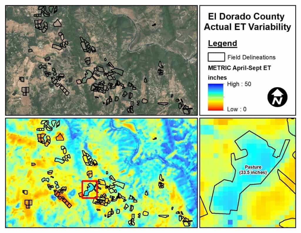
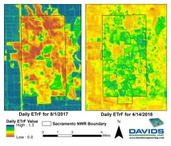
Energy Balance Modeling of Evapotranspiration
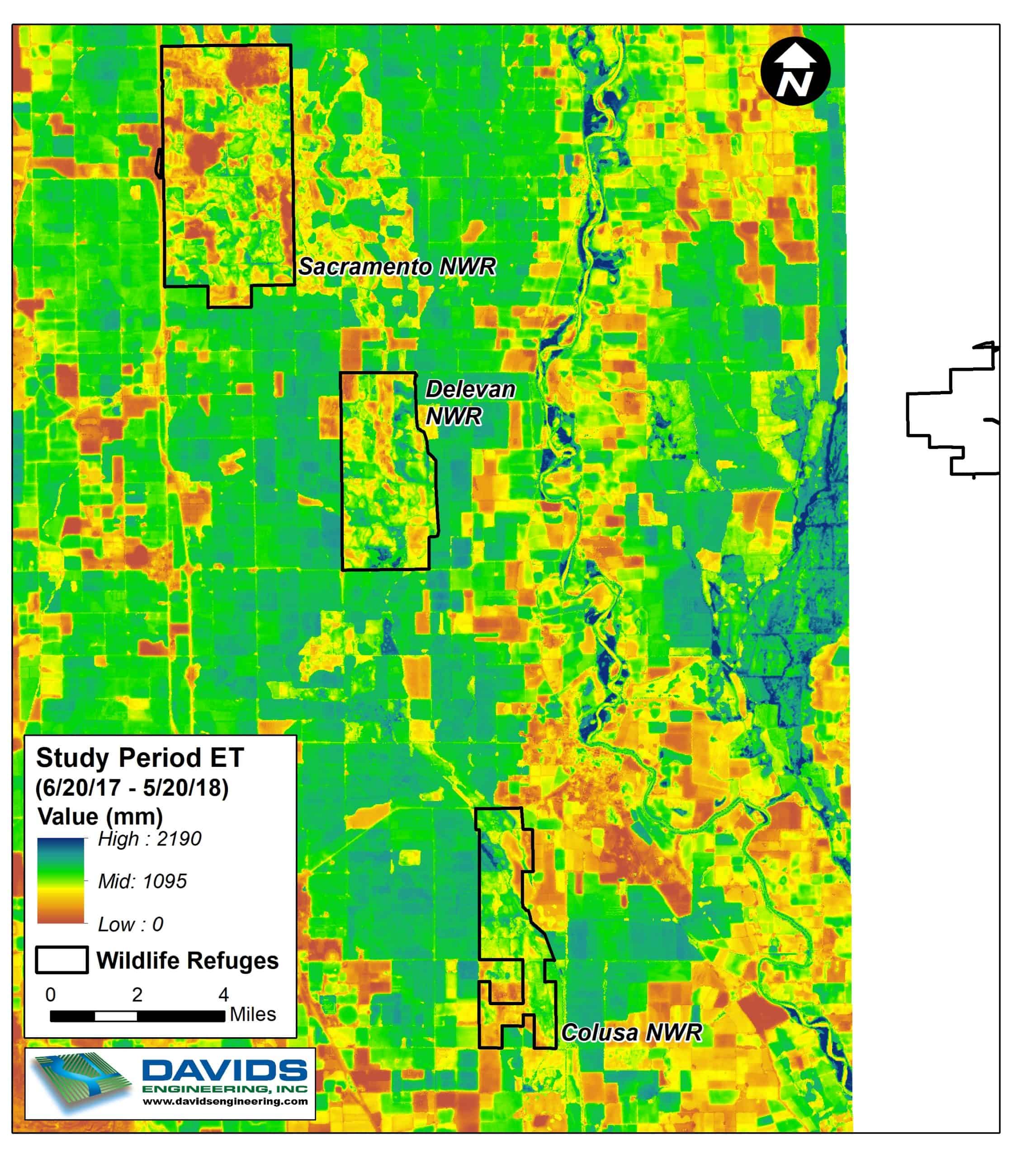
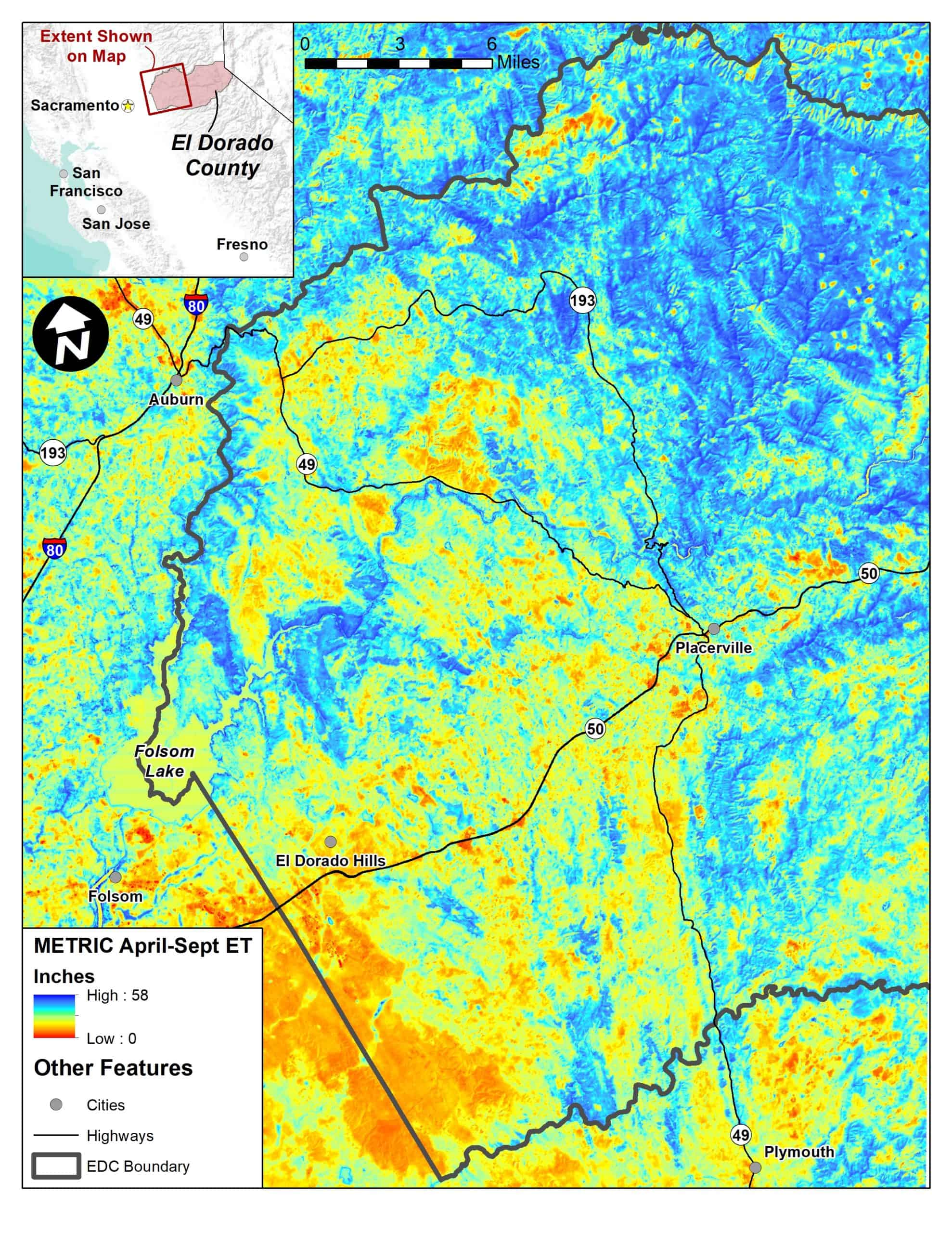
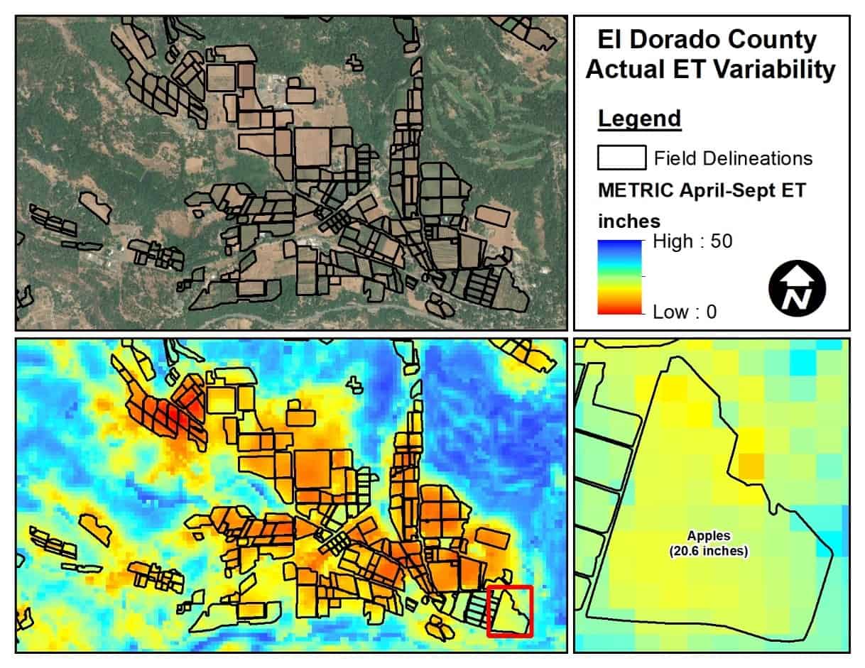
Consumption of water by crops and natural vegetation often represents the largest outflow of water from irrigated and natural systems. We employ energy balance modeling utilizing multispectral satellite imagery to quantify actual evapotranspiration rates across the landscape over time. Energy balance modeling using the SEBAL and METRIC models is a state-of-the-art technique that has been extensively validated in the U.S. and worldwide.
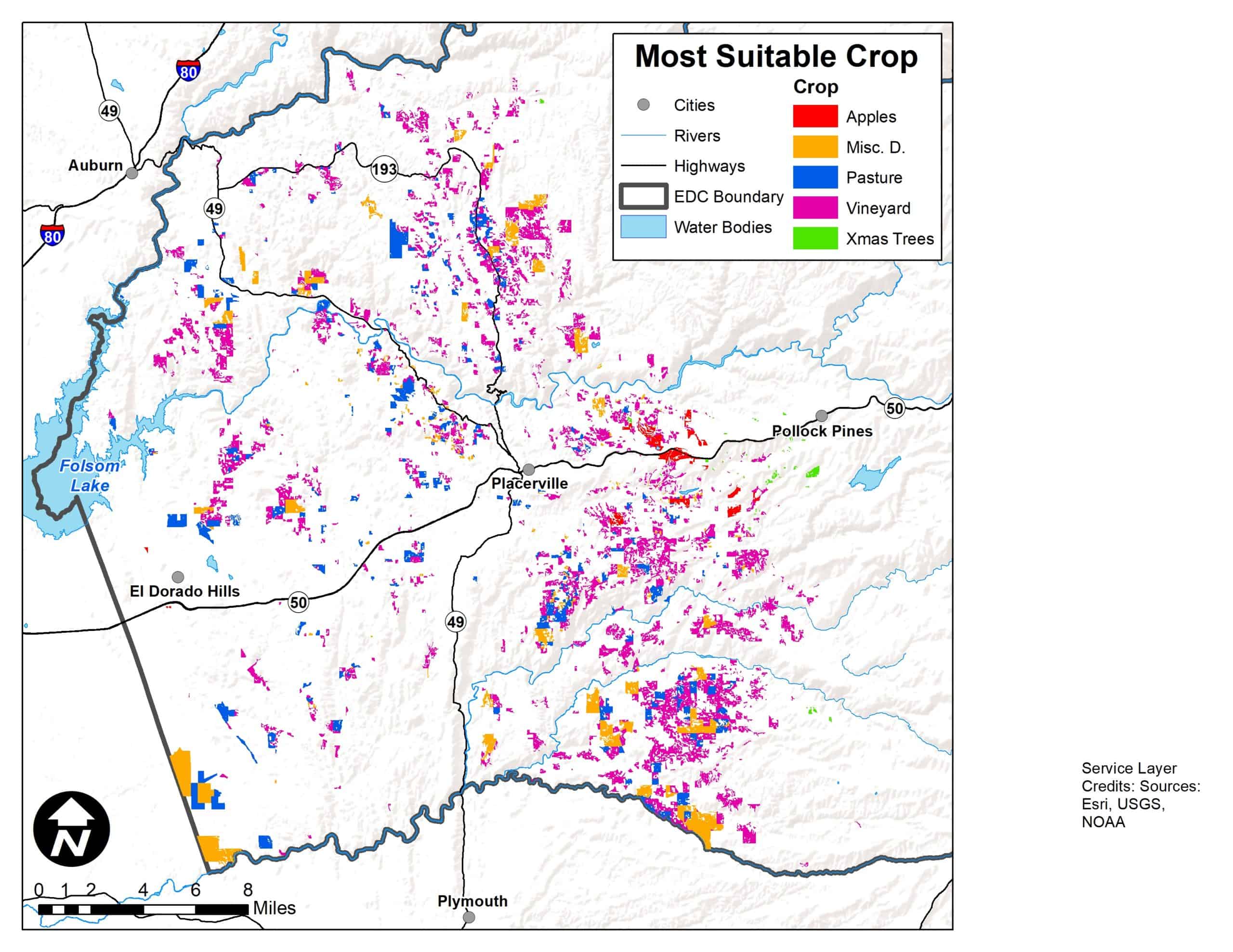
Geospatial Data Assembly and Analysis
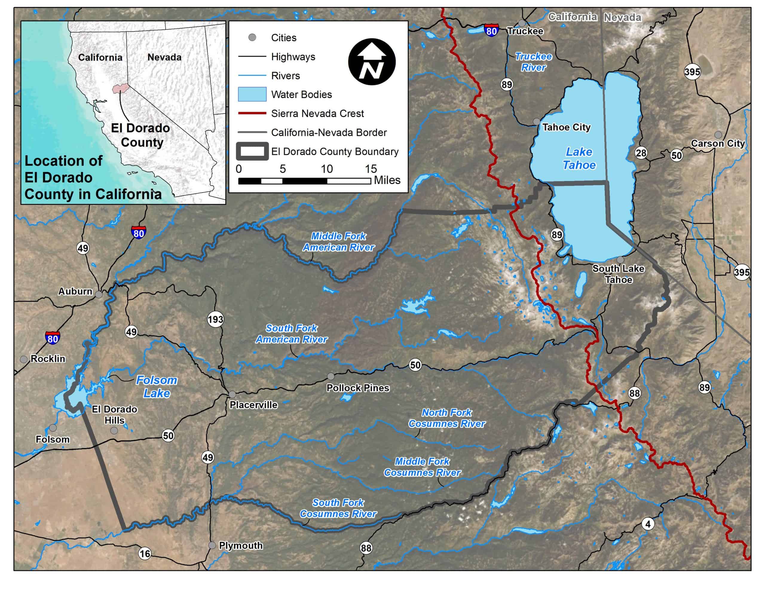
The acquisition and assessment of publicly available or proprietary GIS datasets relevant to the project or problem is critical for success. These datasets are assembled, evaluated, and analyzed using GIS software. Cartographic principles are also employed to visually communicate data, trends, and analysis results. Two frequent analyses are described in more detail below.