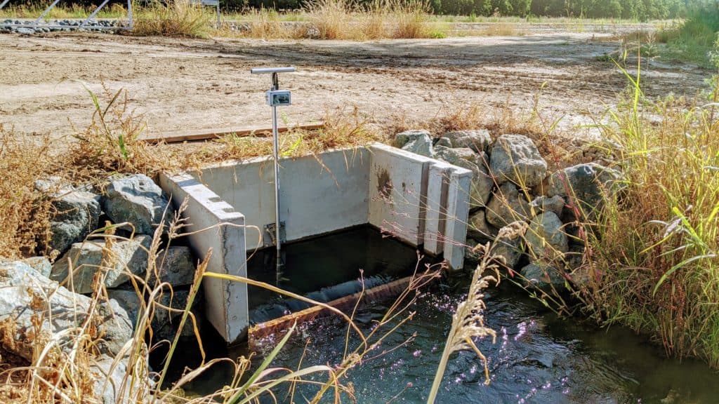
Increasingly, water stewards throughout the west are being required to collect and report water information to regulatory and quasi-regulatory agencies, reflecting increasing public demand for transparency in how water supplies are used. This data must be collected, reviewed for accuracy, stored, analyzed, and incorporated in various reports.
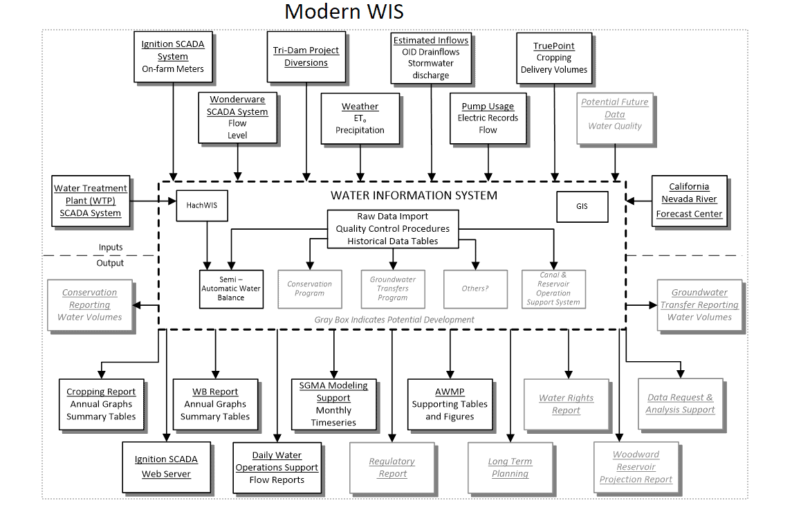
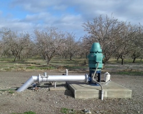
Davids Engineering works closely with water stewards to develop water information systems that perform these functions reliably and cost-effectively. We have designed and implemented a range of water information systems suited to the needs of our clients, from small and simple systems that incorporate manual data collection and spreadsheet-based data management and reporting, to large and complex systems capable of managing hundreds of remotely monitored sites with Oracle-based automated quality control and reporting procedures.
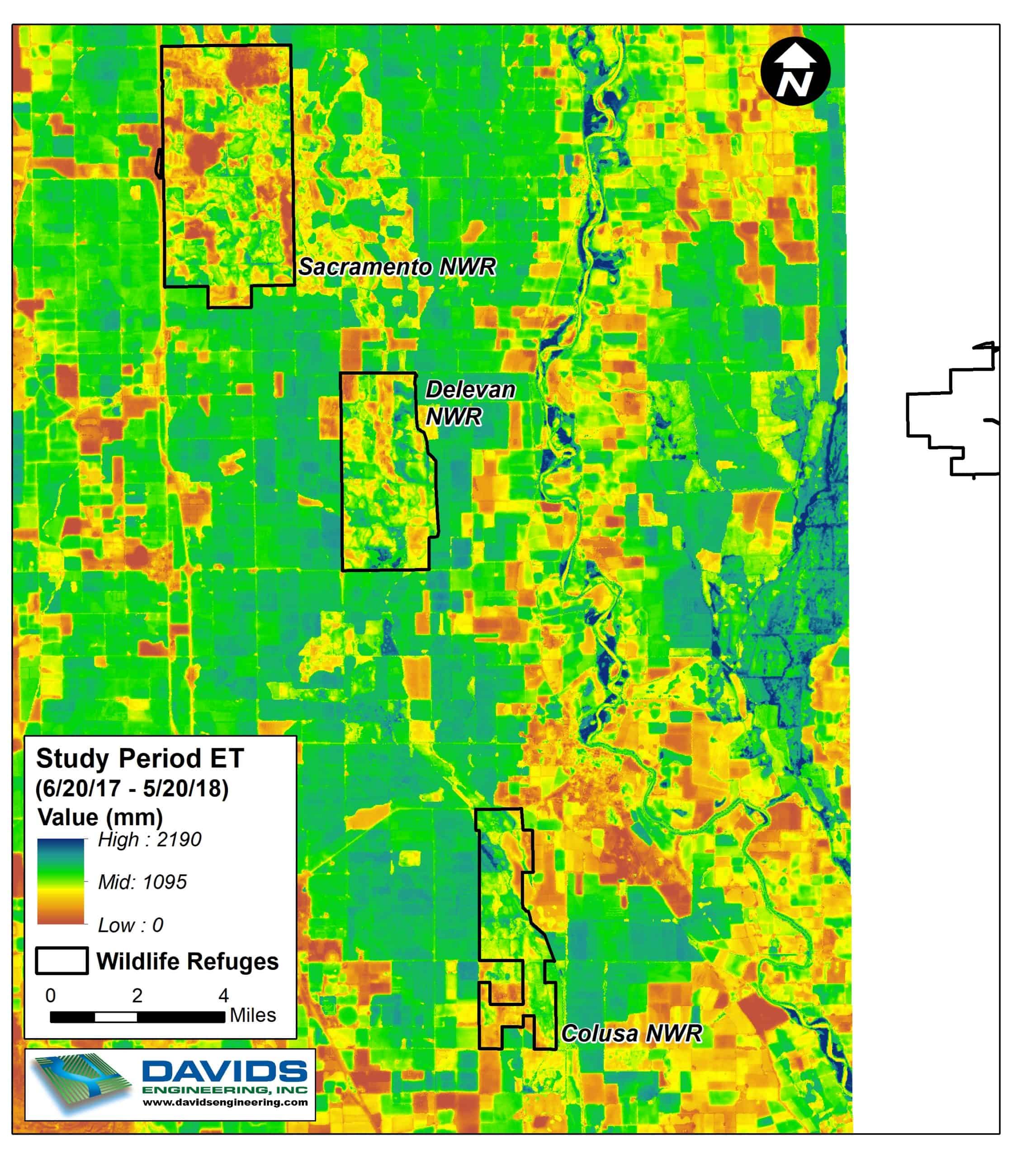
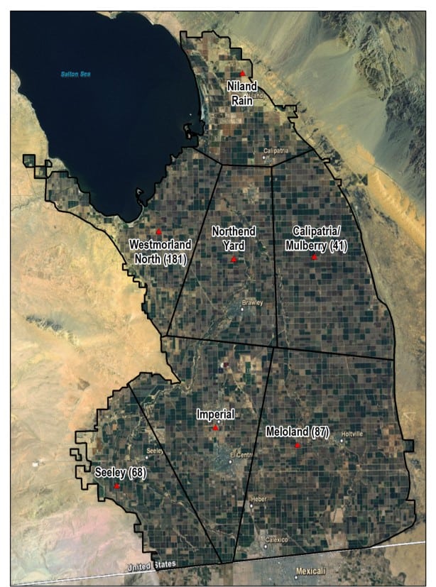
Once data is effectively managed, Davids Engineering helps water stewards to maximize the utility of their data through modeling and analysis. Davids Engineering has expertise in modeling all land surface processes, from surface water and conveyance system flows to crop water use and other water exchanges through the root zone. Davids Engineering applies proprietary and public-domain numerical models to simulate the processes of irrigation and drainage at scales ranging from individual fields to entire irrigation districts or regions. In particular, Davids Engineering has developed methods to incorporate low-cost satellite imagery analysis into spatially-distributed water balance models to develop time series data of irrigation demands and return flows to support the management of surface water and groundwater supplies. Our modeling approach is customized to our clients’ needs, following industry-standard best practices.
Our data management activities typically include one or more of the following:
Davids Engineering works closely with water stewards to develop water information systems that perform these functions reliably and cost-effectively. We have designed and implemented a range of water information systems suited to the needs of our clients, from small and simple systems that incorporate manual data collection and spreadsheet-based data management and reporting, to large and complex systems capable of managing hundreds of remotely monitored sites with Oracle-based automated quality control and reporting procedures.
Once data is effectively managed, Davids Engineering helps water stewards to maximize the utility of their data through modeling and analysis. Davids Engineering has expertise in modeling all land surface processes, from surface water and conveyance system flows to crop water use and other water exchanges through the root zone. Davids Engineering applies proprietary and public-domain numerical models to simulate the processes of irrigation and drainage at scales ranging from individual fields to entire irrigation districts or regions. In particular, Davids Engineering has developed methods to incorporate low-cost satellite imagery analysis into spatially-distributed water balance models to develop time series data of irrigation demands and return flows to support the management of surface water and groundwater supplies. Our modeling approach is customized to our clients’ needs, following industry-standard best practices.
Our data management activities typically include one or more of the following:
Modeling Tools
Davids Engineering has developed methods to incorporate low-cost satellite imagery analysis into spatially-distributed water balance models to develop time series data of irrigation demands and return flows to support the management of surface water and groundwater supplies. Our modeling approach is customized to our clients’ needs, following industry-standard best practices.
Integrated Water Flow Model (IWFM): IWFM is an integrated groundwater and surface water modeling system used for water resources management and planning. IWFM-based model applications have been used to support Groundwater Sustainability Plan (GSP) development for Subbasins across California. At Davids Engineering, we have proven experience developing and refining the surface layer of IWFM models to ensure that surface water supplies and water use are accurately represented.
IWFM Demand Calculator (IDC): IDC is a key component of the IWFM that we use to model flows through the root zone in a physically-base daily or monthly water balance. At Davids Engineering, we use IDC and other root zone water balance tools to support water budget analyses and accurately and consistently track crop evapotranspiration, deep percolation, and other fluxes through the root zone.
Remote Sensing Root Zone (RSRZ) model: Satellite remote sensing techniques are powerful analysis tools that allow crop water use to be quantified across large, diverse landscapes using satellite imagery. Application of remote sensing combined with daily remote sensing-based root zone (RSRZ) water balance modeling allows us to make reliable, consistent estimates of surface water interactions with the groundwater system in the absence of more detailed, ground-based information.
Development of Data Management Processes
Automation of data management processes and organization to support efficient analysis, visualization, and report development. Davids Engineering has tailored water information systems to meet our clients’ needs and quickly analyze data.
Custom Data Management Applications
We design and program custom data management applications to support various processes including import-export, archiving, and quality control of a wide range of land, soil, and hydrologic data.
Water Budgets
Development of detailed, SGMA-compliant water budgets at multiple scales from individual GSAs to entire groundwater basins.