The DE team was honored to have the privilege to present at the U.S. Committee of Irrigation & Drainage’s annual conference October 1-4, 2024. DE team members Jeff Davids, Brandon Ertis, Jacob Winslow and Josh Otto had the opportunity to speak on several important water issues California is facing and the innovative solutions we are implementing with our clients. From SGMA, to groundwater demand management, to estimating groundwater pumping with satellite data, to wetland water management, to customer delivery management, here’s a recap of their presentations!
Remote Sensing Estimates of Groundwater Extraction using the GEEEO Process – Jacob Winslow E.I.T., Assistant Engineer
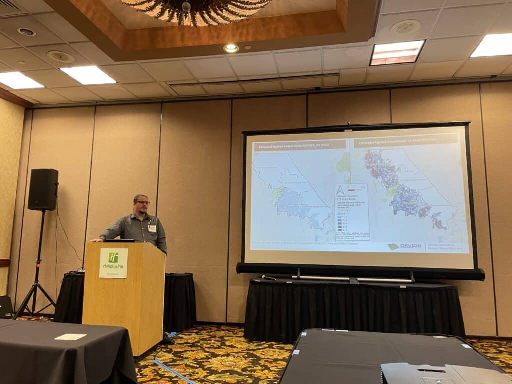
Effective groundwater management requires consistent and accurate estimates of groundwater extraction. In California, groundwater extraction estimates are critical for groundwater sustainability planning and successful implementation of the Sustainable Groundwater Management Act (SGMA). While efforts have been made to expand direct methods for groundwater monitoring, much of the groundwater extraction in California is currently unmeasured, including extraction from privately-owned wells. Recognizing this area of need, a process has been developed that leverages the many remote sensing methodologies and geospatial datasets that have become available in recent years to estimate unmeasured groundwater extraction in agricultural and managed wetland environments. In this process – referred to as the Groundwater Extraction Estimates from Earth Observations (GEEEO) process – a spatial water use analysis is computed using available geospatial data gathered from remote sensing approaches that provide an understanding of current land use, climate conditions, and crop water demands at satellite pixel-scale (typically 30 meters x 30 meters). The GEEEO process then combines this data with other locally available information about surface water supplies and water use to estimate total water use and groundwater extraction, after accounting for the use of other available water supplies.
In his presentation, Jacob provided an overview of the geospatial datasets and methodologies that are used in the GEEEO process to estimate groundwater extraction over large, diverse landscapes in California. His presentation also provided an overview of test cases where the GEEEO process has been used to support SGMA implementation and reporting in a variety of groundwater subbasins in California’s Sacramento Valley.
View Jacob’s full presentation here.
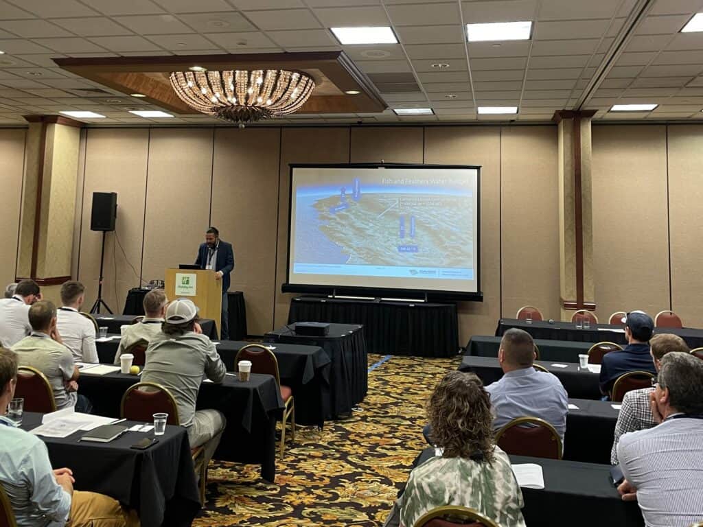
California’s Attempts to Find a Balance Between Fish and Feathers and Folks and Farms Through the Sustainable Groundwater Management Act – Jeff Davids P.E., Supervising Engineer
California’s Great Central Valley was historically teaming with fish and feathers. Starting in the mid to late 1800s, a grand pendulum swing towards folks and farms occurred. This swing included significant modifications to the way water moved through California’s landscapes, including the extensive construction of surface water storage and distribution facilities, and the widespread development of groundwater resources for both folks and farms. In 2014, amidst the specter of acute drought, rapidly falling groundwater levels, and sinking land surfaces, California passed the Sustainable Groundwater Management Act. It had been nearly a century since the state had first initiated a systematic approach towards surface water rights management via the California Water Commission Act of 1913. Since 2014, Groundwater Sustainability Agencies (GSAs) have been formed, Groundwater Sustainability Plans (GSPs) have been developed, and Projects and Management Actions (PMAs) are currently being implemented to avoid undesirable results associated with unsustainable groundwater use.
In his presentation, Jeff explored the first few years of GSP implementation in California, focusing on innovative approaches to demand management. Specifically, he provided an example of groundwater demand management in the Madera County Groundwater Sustainability Agencies (GSAs) involving a groundwater allocation.
On the groundwater supply side, allocations are comprised of both sustainable yield and transitional water volumes. On the groundwater demand side, a combination of remote sensing and flowmeters are leveraged to quantify consumptive groundwater use relative to sustainable groundwater supplies. Credits are also provided to incentivize increased use of surface water in-lieu of groundwater. Groundwater allocation reports are provided to growers on a monthly basis and remaining groundwater supplies can be carried into subsequent years to augment future supplies.
View Jeff’s full presentation here.
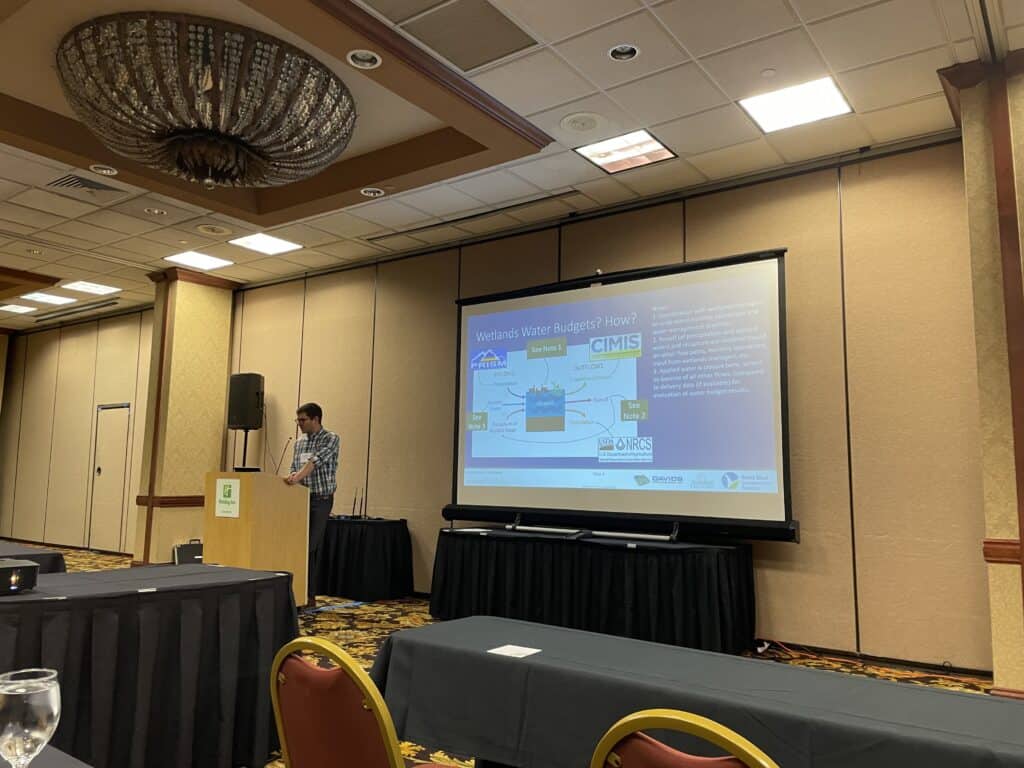
Accounting for Wetlands: Improving Data and Management Tools for an Important, but Understudied Water User in California – Brandon Ertis M.S., P.E., Associate Engineer
Over the past few centuries more than 90% of California’s wetlands have been lost. Today most of the remaining wetlands require human management of habitat and water supplies to survive. The continued conservation of wetlands through wise water management and careful environmental stewardship is necessary to maintain the unique benefits that wetland ecosystems provide and support the biodiversity of the numerous plant, amphibian, and bird species that rely on the unique habitat within wetlands. This conservation of remaining wetland areas is dependent on accurate, reliable data and useful management tools.
Audubon California (Audubon) and Point Blue Conservation Science (Point Blue) have worked to improve the understanding, conservation, and management of remaining wetland areas along the Pacific Flyway in California. Davids Engineering (DE) has worked with Audubon and Point Blue to support these efforts. Initiatives undertaken and completed by Audubon, Point Blue, and DE include:
- Developing the Wetlands Water Budget Tool (WWBT), a spreadsheet-based tool designed for evaluating relative impacts on applied water demands under various user-specified habitat and management regimes, and under projected climate change scenarios. The tool was designed in MS Excel in order to make it accessible and user-friendly for potential users without a strong technical background in water budgets and accounting.
- In coordination with wetlands managers, applying the WWBT to creation of wetlands water budgets for specific managed wetlands areas in California.
- Evaluating impacts of projected climate change scenarios on future applied water requirements for managed wetland areas.
Evaluating actual ET and habitat coefficients (based on remote sensing data from OpenET) relative to ET and habitat coefficients modeled in the WWBT.
Brandon’s presentation provided a summary of the work described above that has been completed to date, along with recommendations for future work related to these important wetland areas in California.
View Brandon’s full presentation here.

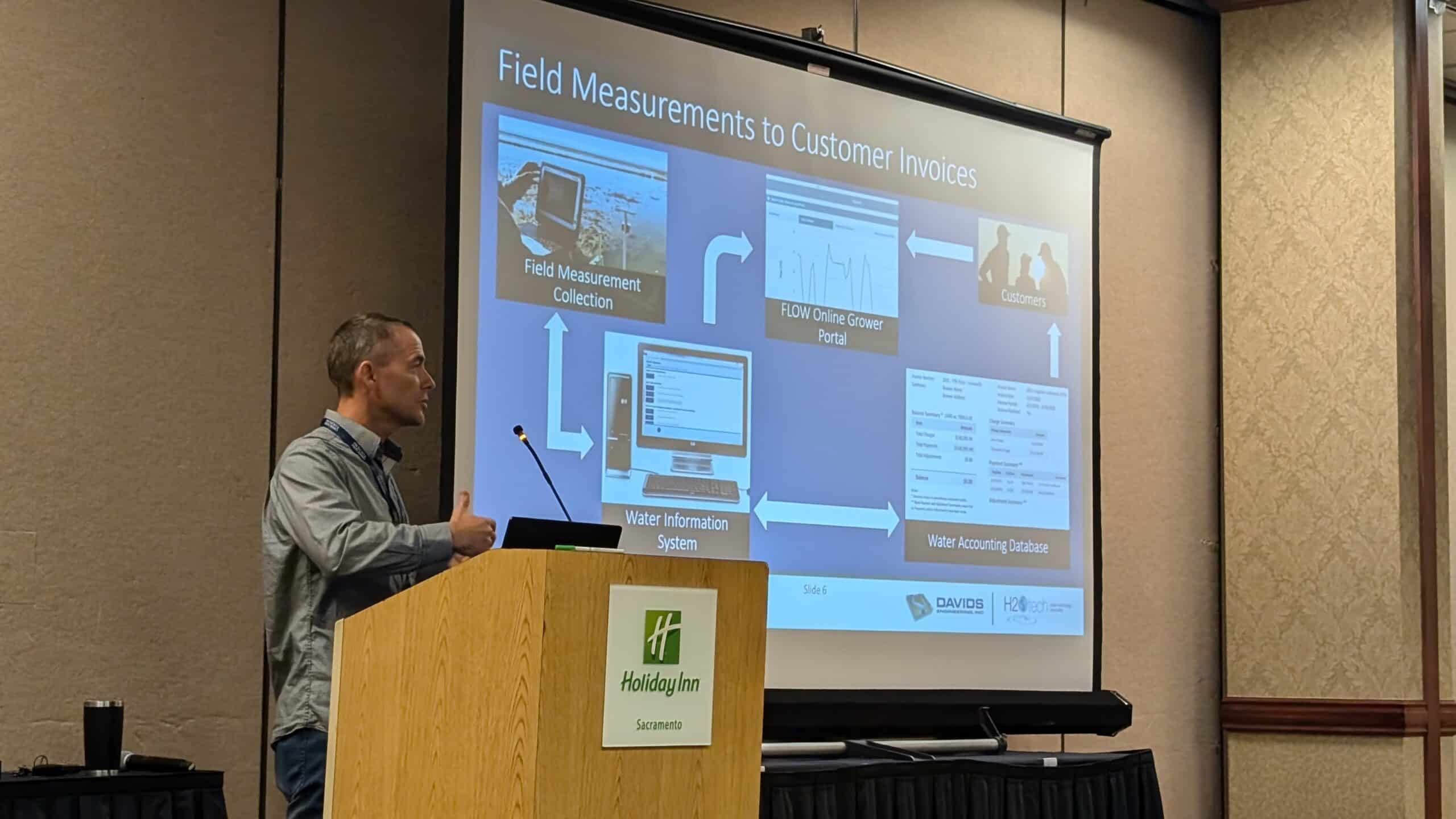
Bridging the Farm-Gate Delivery Data Gap: Fifteen Years of SBx7-7 Implementation – Josh Otto, Staff Technician
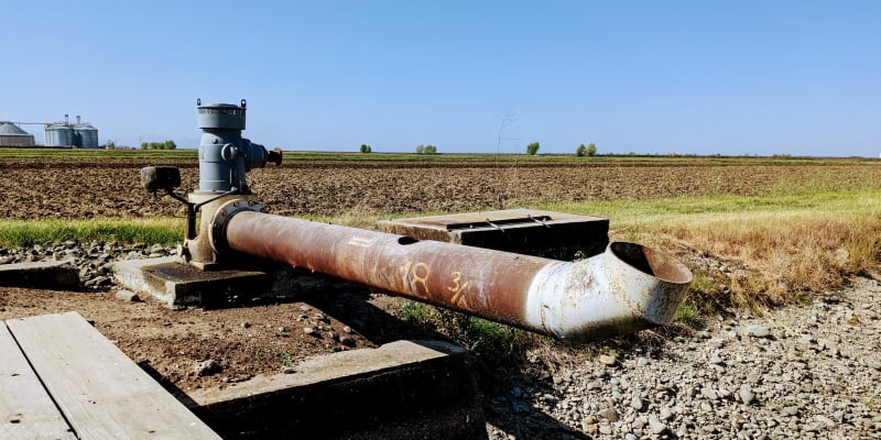
In November 2009, Senate Bill x7-7 (SBx7-7) was enacted to enhance agricultural water management in districts exceeding 25,000 irrigated acres by mandating the measurement of all farm-gate deliveries, and implementation of volumetric billing (at least in part). While the need for delivery measurement has grown due to both SBx7-7 and increasing pressure to carefully manage and account for water supplies, compliance approaches from water districts have been mixed. Significant challenges persist in implementing farm-gate measurement and managing related data for water deliveries. These challenges include infrastructure improvements; the low cost of water relative to the high cost of implementation typical in many water districts; uncertain policy implications and integration with the Sustainable Groundwater Management Act (SGMA); and measurement data management, QA/QC, and integration into volumetric billing.
Fifteen years after SBx7-7, Josh looked at how the RemoteTracker system has addressed the farm-gate delivery data gap at a field-level scale, helping to manage data for over 500,000 acres of irrigable land in the Sacramento Valley. In the field, the RemoteTracker system utilizes lab-tested sensors compliant with the California Department of Water Resources’ 5% accuracy standards and equips operators to measure volumetric flows at each farm-gate. In the office, it provides robust and user-friendly tools for managing and summarizing delivery measurement data and generating invoices that can align with a variety of billing structures and procedures.
Josh’s presentation reflected on fifteen years of implementing farm-gate delivery measurement. He highlighted the lessons learned along the way, including successes and ongoing challenges, and provide conclusions and recommendations as we continue to work towards bridging the farm-gate delivery data gap in support of data-driven sustainable water management.
View Josh’s full presentation here.
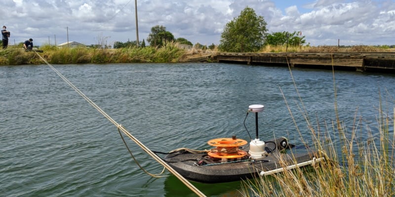
Characterizing Stream-Aquifer Exchanges with Stream Reach Water Budgets – Jeff Davids P.E., Supervising Engineer
The Sustainable Groundwater Management Act (SGMA) of 2014 identified the depletion of interconnected surface water as one of six potential undesirable results of unsustainable groundwater use. Throughout California, stream-aquifer interactions have been identified as an important data gap for assessing groundwater sustainability that Groundwater Sustainability Agencies (GSAs) must take steps to understand and assess by 2025 (for critically overdrafted subbasins) or 2027 (for non-critically overdrafted subbasins). Model characterizations of stream-aquifer interactions are helpful for evaluating scenarios, but often lack real-world measurements for calibration of streambed conductance, which are necessary for accurately quantifying the magnitude of stream-aquifer interactions. Additionally, stream geometries are often poorly characterized because of a lack of ground-truthed stream survey data.
In his presentation, Jeff covered four applications of stream-reach water budgets to characterize stream-aquifer interactions over a variety of spatial scales and stream sizes, ranging from Big and Little Chico Creeks up to the Yuba and Feather Rivers. These measurements are being used to improve the understanding and model representations of stream-aquifer interactions within the Butte, Colusa, Corning, and Yuba Subbasins. Specifically, the presentation will be focused on results from stream-reach water budgets performed on portions of Big Chico Creek, and the Feather and Yuba Rivers. On Big Chico Creek, periodic streamflow measurements were performed at six different sites ranging from the start of the valley alluvial on the eastern side of Chico down to the confluence with the Sacramento River from May through August of 2020 through 2022. The results indicated that approximately 10 times more seepage to the groundwater system was occurring than prior modeling results indicated. These results highlight the importance of ground-truthing model parameters with empirical measurements whenever possible.
View Jeff’s full presentation here.